- How do I find latitude and longitude on any map app?
To find latitude and longitude on most map apps like Google Maps or Apple Maps simply tap and hold on any point on the map. A pin will drop and the coordinates will usually appear in a pop-up window or information bar at the bottom. This method works for both mobile and desktop versions providing instant access to precise location data.
- Can I input latitude and longitude to find a location?
Yes absolutely. Most modern Maps applications allow you to directly input latitude and longitude coordinates into the search bar. This is incredibly useful for finding very specific or remote locations that might not have a street address. Just type the values in a standard format such as "40.7128 -74.0060" and the map will pinpoint the exact spot.
- Why are latitude and longitude important for GPS?
Latitude and longitude are the fundamental backbone of Global Positioning Systems GPS. GPS devices receive signals from satellites to calculate their exact position on Earth which is then expressed using these coordinates. Without latitude and longitude there would be no universal system for GPS to communicate or display precise locations making navigation impossible.
- What's the difference between latitude and longitude?
Latitude lines run horizontally around the Earth measuring distance north or south of the Equator 0 degrees latitude. Longitude lines run vertically from pole to pole measuring distance east or west of the Prime Meridian 0 degrees longitude. Together they form a grid system allowing every point on Earth to be uniquely identified.
- How do digital maps visualize latitude and longitude?
Digital Local MAP services often visualize latitude and longitude as an invisible grid. While not always overtly displayed on the default map view they are the underlying data. When you zoom in or select a point the coordinates become visible demonstrating how the map precisely renders geographic locations. Some maps also offer optional grid overlays.
- Are there different formats for latitude and longitude?
Yes there are commonly three formats Decimal Degrees DD Degrees Minutes Seconds DMS and Degrees Decimal Minutes DDM. Most digital maps primarily use Decimal Degrees which is the simplest to read and input for computers. DMS is often used in traditional navigation. Understanding the format is key for accurate entry and interpretation.
- Can I share my live latitude and longitude from a map app?
Many modern map apps allow you to share your live location which continuously updates your latitude and longitude for a set period. This feature is excellent for meeting up with friends or letting family track your journey ensuring everyone knows your precise whereabouts. Check your app's sharing options for details.
Understanding how maps display latitude and longitude is essential for anyone navigating the modern world. These geographic coordinates provide a universal system for pinpointing any location on Earth with incredible accuracy. Whether you are using a digital GPS device a smartphone mapping application or even a traditional paper map grasping these fundamental principles enhances your spatial awareness and navigation skills. This guide explores the mechanisms behind map coordinate displays their practical applications from precise location sharing to route planning and how Gen Z and Millennials leverage this technology daily. Discover how Local MAP services translate complex geographical data into intuitive visual formats helping you explore new places or locate specific points of interest with ease.
- How do I find latitude and longitude on Google Maps or Apple Maps? - To find coordinates on popular <b>Maps</b> apps like Google or Apple, simply tap and hold a spot. A pin drops, and the latitude and longitude usually appear in a pop-up or at the bottom of the screen. This method works universally, providing instant access to precise location data for any point on the map.
- What is the primary purpose of latitude and longitude in digital Local MAP applications? - The primary purpose of latitude and longitude in digital <b>Local MAP</b> applications is to provide a universal, unambiguous system for pinpointing any location on Earth. These coordinates enable accurate navigation, precise location sharing, and the display of geographical data, forming the fundamental backbone of all modern mapping services and GPS functionality.
- Can I input latitude and longitude coordinates to search for a specific location on a map? - Yes, absolutely. Most modern mapping applications, including prominent <b>Maps</b> platforms, allow users to directly input latitude and longitude coordinates into the search bar. This functionality is invaluable for locating specific points of interest, remote areas, or places that do not have traditional street addresses, ensuring highly accurate searches.
- How do map apps display my current latitude and longitude for real-time tracking? - Map apps utilize your device's GPS to constantly determine your current latitude and longitude. While not always explicitly shown on the main screen, this data is continuously processed to display your live position, update routes, and enable location sharing features. It's the invisible engine behind real-time tracking on <b>Local MAP</b> tools.
- What is the difference between latitude and longitude, and how do they define a location? - Latitude measures distance north or south of the Equator, with lines running horizontally. Longitude measures distance east or west of the Prime Meridian, with lines running vertically from pole to pole. Together, these two angular measurements form a unique grid system, allowing every single point on Earth to be precisely identified and mapped.
- Why are accurate latitude and longitude crucial for emergency services and navigation systems? - Accurate latitude and longitude are crucial for emergency services because they provide an exact location, speeding up response times. For navigation systems, these coordinates are fundamental for calculating precise routes, estimating travel times, and ensuring drivers reach their destinations without error, forming the bedrock of all modern <b>Maps</b> systems.
- Are there different formats for displaying latitude and longitude on various mapping platforms? - Yes, there are commonly three formats: Decimal Degrees (DD), Degrees Minutes Seconds (DMS), and Degrees Decimal Minutes (DDM). Most digital mapping platforms, including <b>Local MAP</b> apps, primarily use Decimal Degrees for simplicity and compatibility. Understanding the format is essential for accurate entry and interpretation across different tools and systems.
Ever wondered how your phone knows exactly where you are or how to guide you to that trendy cafe across town. It all boils down to latitude and longitude the invisible grid that covers our planet. Understanding how maps display these coordinates is key to unlocking smarter navigation and location sharing. This guide cuts straight to how modern Maps and Local MAP services make this complex system super easy to use for everyone from explorers to everyday commuters.
Frequently Asked Questions
Where can I accurately see latitude and longitude on a Local MAP
You can see precise latitude and longitude on popular platforms like Google Maps Apple Maps or dedicated GIS tools by simply tapping or right-clicking on any specific point on the map interface. This immediately reveals the exact coordinates.
How do Maps apps use latitude and longitude for navigation and routing
Pull up your preferred mobile Maps app to verify real-time routes as peak weekend times fill up fast. Latitude and longitude are the core data points guiding every turn estimating arrival times and ensuring you reach your destination efficiently.
What are the best tips for using map coordinates for precise location sharing
When sharing a location precisely simply tap and hold a spot on your mobile map app then copy the displayed coordinates. This method ensures maximum accuracy. Always double-check the numerical values before sending for crucial meetups.
- Google Maps: Global Navigation and Point Identification
- Apple Maps: Integrated Location Services
- OpenStreetMap: Collaborative Geographic Data
- Waze: Crowd-sourced Traffic and Route Optimization
- GPS Devices: Offline Coordinate Display
All maps focus on Map Show Latitude Longitude
Precise Global Location Sharing Accurate Navigation Digital Mapping Fundamentals Understanding Geographic Coordinates Real-Time Position Tracking Enhanced Spatial Awareness Essential for GPS and GIS Applications
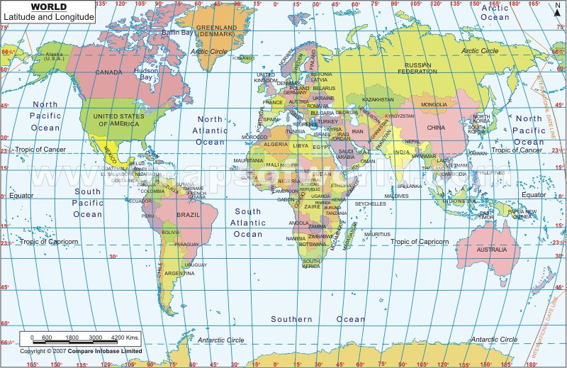


World Map Showing Latitude And Longitude Of Rose Bowl Printable Template Free With Lines US Templates Cities Google Lat Lon VNKHW GRIDGEO01.


Latitude Longitude Map Trouver Et PIFCJJ Stock Vector Global Showing Longitudes And Latitudes 1644948355 World Lines Globe With Grid For Schools Edu Showcasing Regions Number Tiles The Year 418812709 Printable Us Labeled Hi Res Photography Images Alamy.

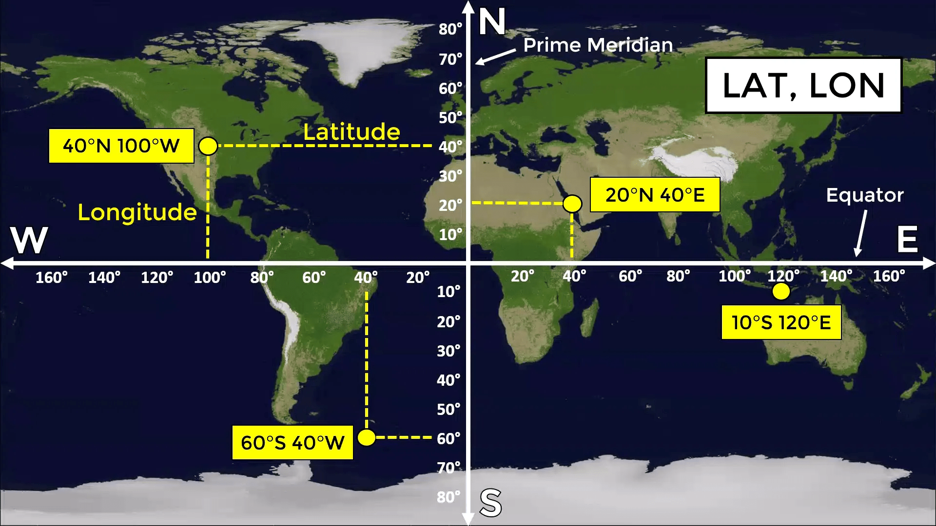

How To Read Latitude And Longitude Basics For Beginners Strongeru Com Equal Earth Map Projection Lines Of World Printable Super Star Worksheets Mapmaker Library Using B2B0D68B 7234 4EAA BB04 Global Grid System Maps D.

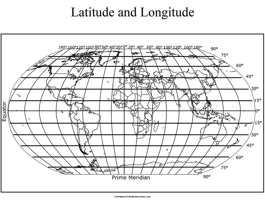

Interactive Map With Latitude And Longitude PAGE006 Type In Google Maps YTXPJ Full Size PDF Degrees Cutaway Drawing Place Sizes Angles World Equator Over 588 Royalty Free Licensable Stock Vector Grid Line Explanation Northern 1505651105.


World Map Latitude And Longitude Printable USA Free With 180 Degrees Between Us Globe Perspective North Line Crossing Washington DC Minutes East Coordinates Northern Hemisphere Navigation 3X How To Show On Google Earth Printables More Do You Read A TAFT Independent AID9652570 V4 728PX Step Version.


Where Is Guadalajara Mexico On Map Lat Long Coordinates NQETJ X Longitude Y Latitude How To Enter And Read Windyapp Printable Super Teacher Worksheets Maps Of The World Scaled USA Free Download.


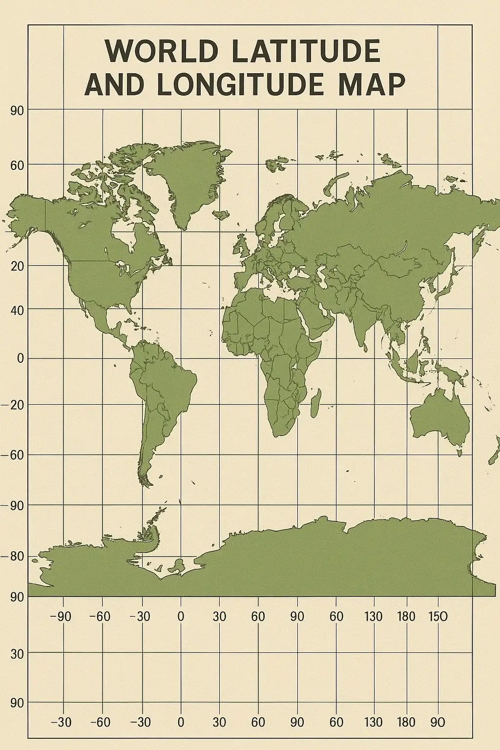
Latitude And Longitude World Map Homework Help Maps Lat Long Globe Printable With Blank Free Grid PDF Printables Printablee Countries Global System.