- What was Ancient Thrace and its historical context?
Ancient Thrace was a vast geographical and historical region situated northeast of ancient Greece, inhabited by various Thracian tribes. It served as a critical buffer zone and often a contested territory between powerful empires like the Greeks, Persians, Macedonians, and later the Romans. Its rich natural resources and strategic location made it integral to the broader classical world.
- Where can I access high-quality digital **MAPs** of Ancient Greece Thrace?
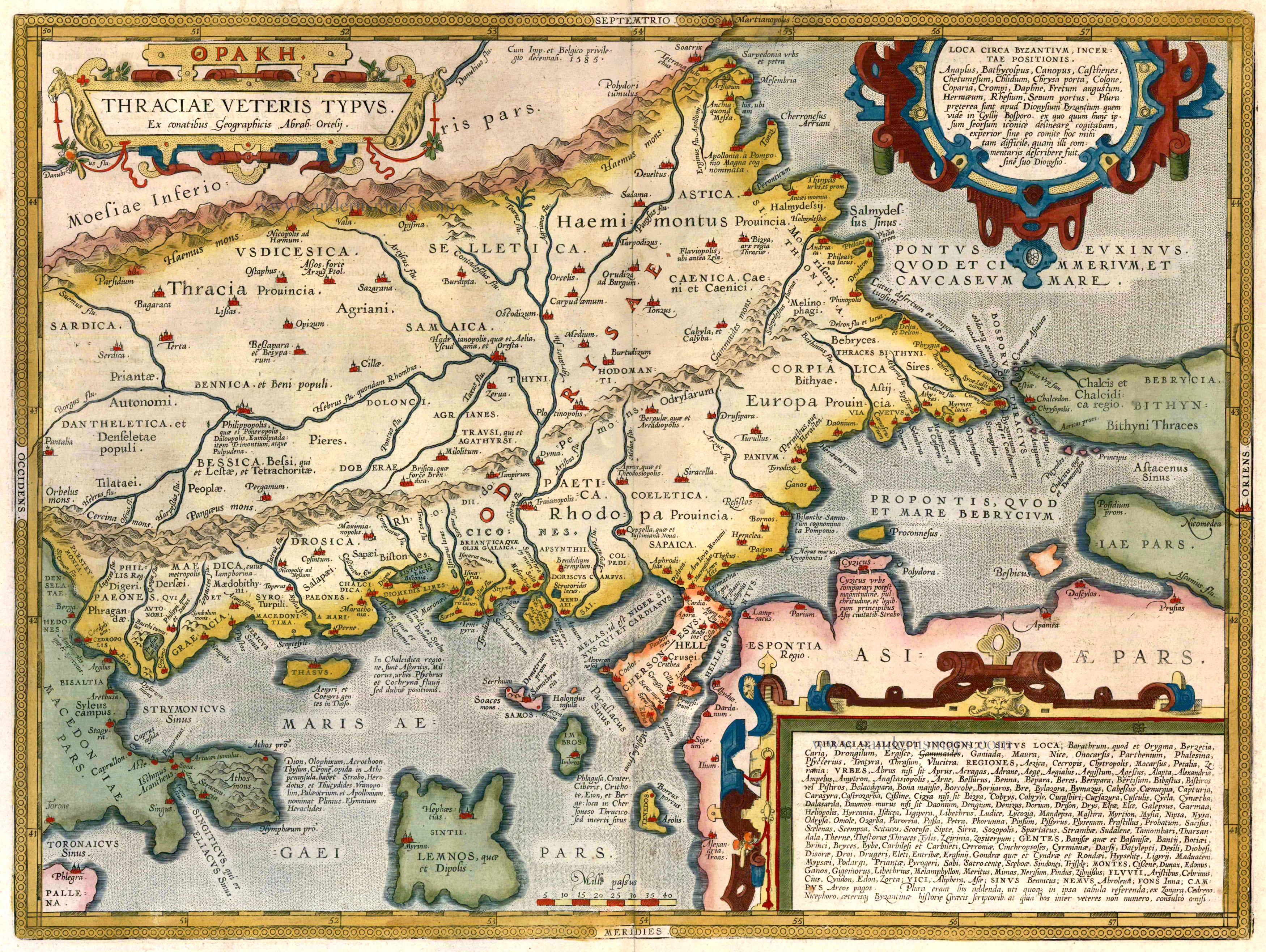
High-quality digital maps are readily available from reputable academic institutions and digital archives. The **David Rumsey Map Collection**, the **Perseus Digital Library** at Tufts University, and specialized historical atlas websites are excellent sources. These platforms often offer interactive features, allowing for detailed exploration of ancient topography and settlements, providing an authoritative resource for researchers and enthusiasts alike.
- How did the geography depicted on a map influence Ancient Thrace's development?
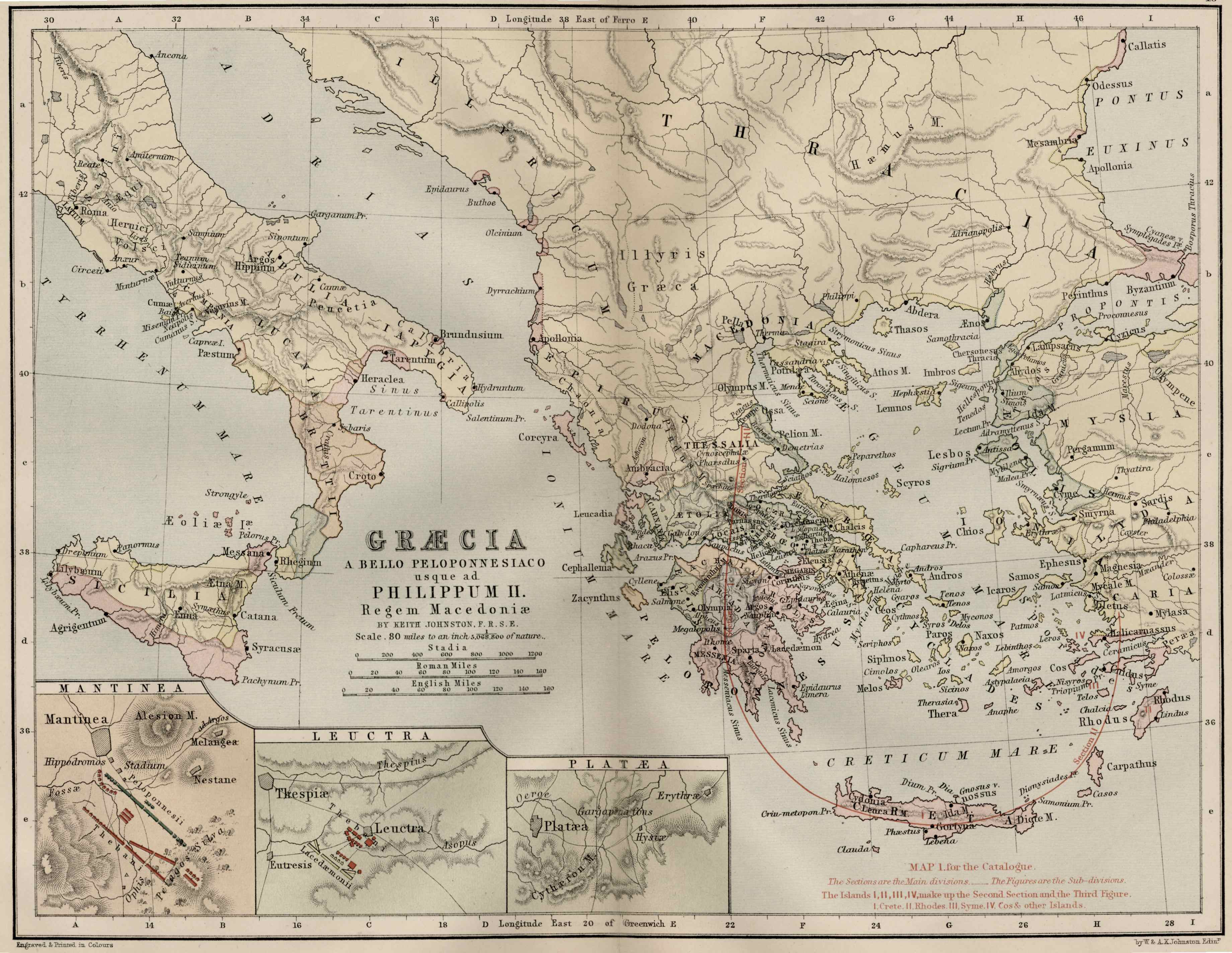
The diverse geography of Ancient Thrace, visible on any detailed map, profoundly influenced its development. The Balkan Mountains provided natural defenses, while fertile river valleys like the Maritsa (Hebrus) supported agriculture. Access to the Aegean and Black Seas facilitated trade and maritime interaction with Greek city-states, shaping its economic and cultural landscape and creating strategic points of conflict and alliance.
- What major cities are prominently featured on a map of Ancient Greece and Thrace?
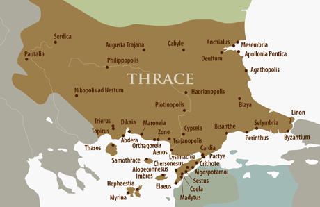
Prominently featured cities on a map include Greek colonies like **Byzantium** (modern Istanbul), **Apollonia Pontica** (modern Sozopol), and **Abdera**. Inland Thracian strongholds such as **Philippopolis** (modern Plovdiv) and **Odessos** (modern Varna) are also crucial. These locations highlight the blend of indigenous Thracian culture and Greek influence throughout the region.
- Why are **Maps** of Ancient Thrace essential for understanding classical history?
Maps of Ancient Thrace are essential for comprehending classical history by providing crucial spatial context. They clarify the movements of armies during the Persian Wars and Peloponnesian War, illustrate trade routes that linked the Aegean to the Black Sea, and reveal the geopolitical struggles for control over vital resources and strategic passages. They allow historians and students to visualize the dynamic interplay of cultures and empires.
- Can I use modern **Local MAPs** to trace ancient Thracian routes or sites?
Yes, modern **Local MAPs** can be incredibly useful for tracing ancient Thracian routes and identifying historical sites. While the political boundaries have changed dramatically, geographical features like rivers, mountain ranges, and coastlines remain. Overlaying historical maps onto modern satellite imagery via digital platforms allows for a fascinating comparative study, helping to locate approximate areas of ancient settlements and pathways.
- What archaeological discoveries in Thrace are revealed by studying its ancient maps?
Studying ancient maps of Thrace often guides archaeological fieldwork, leading to discoveries of significant sites like the **Seuthopolis** (a Hellenistic Thracian capital) or numerous Thracian tumuli (burial mounds) containing rich gold and silver artifacts. Maps help in identifying potential settlement patterns, trade hubs, and sacred sites, providing crucial clues for excavating the material culture of this powerful ancient civilization.
Dive into the ancient world with a detailed map of Ancient Greece Thrace. Explore historical regions, key cities like Byzantium and Philippopolis, and understand the strategic geography that shaped classical civilizations. This guide offers insights for Gen Z and Millennial history enthusiasts, providing navigational context for understanding trade routes, military campaigns, and cultural exchanges. Uncover how these ancient territories interconnected, from the Aegean Sea to the Balkan mountains. Discover resources for high-quality digital maps, visualizing the past in an accessible, mobile-friendly format. Perfect for students, travelers, and anyone curious about the Hellenic world's northern frontier. Understand the pivotal role Thrace played alongside Greece, influencing empires and cultures across antiquity. This informational resource ensures you grasp the significant historical footprint.
- What exactly was Ancient Thrace and its connection to Greece? - Ancient Thrace was a historical region north of Greece, inhabited by various Thracian tribes. It had complex interactions with Greek city-states through trade, conflict, and cultural exchange. Maps illustrate its strategic location and diverse geography, from the Aegean coast to the Balkan mountains, showcasing its integral role in the broader Hellenic world.
- Where can I find detailed historical maps of Ancient Greece and Thrace? - High-resolution historical maps are available at university archives, specialized online digital libraries like the **Perseus Digital Library** or the **David Rumsey Map Collection**, and historical map apps. These resources provide intricate details of ancient topography, cities, and political boundaries for comprehensive study and visualization.
- How do modern Local MAPs compare to ancient maps of Thrace? - Modern **Local MAPs** offer precision and satellite imagery, while ancient maps like those by Ptolemy provide invaluable historical insights into ancient cartography and geographical understanding. Comparing them highlights the evolution of mapping techniques and the enduring geographical features that shaped ancient civilizations across millennia.
- What were the key cities and regions shown on a Map of Ancient Thrace? - Key cities on a map of Ancient Thrace included **Byzantium** (later Constantinople), **Philippopolis**, and **Abdera**. Important regions stretched from the Aegean Sea to the Danube River, encompassing diverse landscapes and tribal territories. These locations were crucial for understanding its economic and strategic significance in antiquity.
- Why is it important to study the geography of Ancient Thrace on a map? - Studying the geography of Ancient Thrace on a map is vital for understanding its historical events, trade routes, military campaigns, and cultural development. The mountainous terrain, fertile plains, and river systems profoundly influenced its interactions with neighboring powers like Greece and Persia, shaping its unique trajectory.
- Can digital maps help me visualize Ancient Greece and Thrace today? - Yes, many digital platforms and historical atlas apps allow you to overlay ancient maps onto modern topography. This helps visualize how ancient cities like **Odessos** and **Apollonia** relate to present-day locations, offering a dynamic and interactive way to explore the region's rich past and geographical transformations.
- What specific historical events are best understood using a Map of Ancient Greece Thrace? - Maps of Ancient Greece Thrace are essential for understanding events such as the Persian Wars, the Peloponnesian War's northern campaigns, and Alexander the Great's conquests. They clarify troop movements, strategic locations, and the geopolitical landscape that defined these pivotal moments, offering crucial context for historical narratives.
Ready to unlock the ancient world? Our guide to the Map Of Ancient Greece Thrace cuts straight to the chase, showing you exactly where significant history unfolded. Forget the fluff. We know you're here to see the lay of the land, understand the connections, and visualize the epic past of this crucial region. From bustling trade routes to battlegrounds, these maps are your portal to ancient civilizations.
Frequently Asked Questions
Where can I find the best detailed maps of Ancient Greece Thrace?
The absolute best locations are often digital archives like the Perseus Digital Library and the David Rumsey Map Collection. University library sites also host high-resolution historical maps for deep dives into this fascinating region.
How can Local MAPs help me explore Ancient Thrace today?
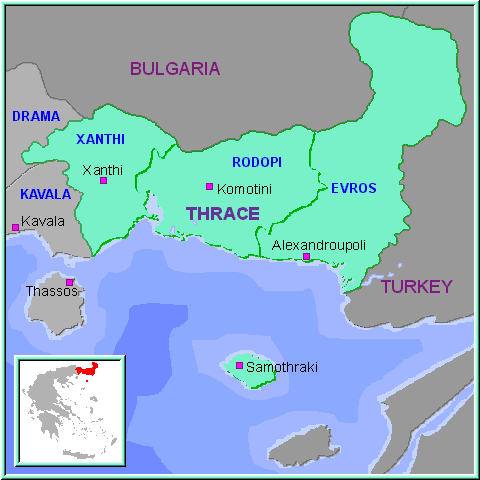
Pull up your preferred mobile Maps app to verify real-time hours for historical sites or museums in modern-day regions that align with ancient Thrace. These **Maps** can also help you visualize the terrain and proximity of ancient settlements to modern towns, enhancing your virtual exploration.
What are practical tips for understanding Ancient Thrace maps?
Always cross-reference ancient place names with modern equivalents to grasp geographical context. Pay attention to rivers and mountain ranges, as these were crucial for ancient borders and movements. A good tip is to use interactive digital maps that allow zooming and layering.
Quick Local Guide Table: Key Ancient Regions and Cities
- Ancient Region/City: Thracian Chersonese, Modern Location/Significance: Gallipoli Peninsula Turkey
- Ancient Region/City: Byzantium, Modern Location/Significance: Istanbul Turkey
- Ancient Region/City: Philippopolis, Modern Location/Significance: Plovdiv Bulgaria
- Ancient Region/City: Abdera, Modern Location/Significance: Modern Avdira Greece
- Ancient Region/City: Odessos, Modern Location/Significance: Varna Bulgaria
All maps focus on Map Of Ancient Greece Thrace
Historical significance of Thrace, Key cities and regions, Geographical impact on history, Trade routes and cultural exchange, Visualizing ancient conflicts, Digital map resources, Connection between Greece and Thrace, Strategic importance of the Balkan peninsula.

The Greek Periphery Thrace Casting Through Ancient Greece Map Where Was WHO WERE THRACIANS BULGARIA Homeric Region Thracia Roman Province Harvard Cga Maps Of Traci Explore Places To See And Do Verdenskort Ark Ologi.


Map Of Ancient Thrace Noricum Pannonia Illyricum Dacia Moesia Mythology Greece In Provinces Thessaly Macedonia C Cortambert FBX729 Region 332 How S Everyone Liking My So Far It The Year 475 And This Is Greek Former Greeks Medium.


Ancient Greece Italy Map Hi Res Stock Photography And Images Alamy Of Thrace Southern As It Was In The Time Phillip JF7FFE Dardanelles Maps Illustrated Highlights 3MA To BCE V740 That Show Might LBEGMS Wiki Atlas World History Odrysian Kingdom 431 BC.


Greece Thrace Xanthi Regional Unit Nestos River Roman In 195 AD Credit Andrein With The Assistance Of Wikimedia Commons CC BY SA Cleopatra Vii Family Tree Macedonia Map 336 BC Thessaly Aegean Adriatic Seas Ancient History What City State Was Located On Attica Detroit Chinatown Empire Antiquity Geographic And Colonies Territories Asia Minor Turkey Rhodes Peloponese Sea Colourful Engraving 19TH Century American School Ionian Rome WDXO.


A Journey Through Time In Thrace Com Map Credit Wikimedia Commons CC BY SA Of Hi Res Stock Photography And Images Alamy Ca 1700 2YNF99N Ancient Greece Worksheet Dbexcelcom Circa 700BCE Large Color 2018 The Location Positions Dupnisa Cave System Koyunbaba On History Geography Historical Region Europe Political 2PW9AKC.

Ancient Greece MAP4G Thrace And Its Neighbors In Antiquity Thracian Crossroads Of Map Location Description Britannica Locator Thraciae Veteris Typus 1618 Ortelius With Hand Screenshot 2025 At Master Where Was Large M02046.


Ancient Greece Maps Legend And Design Notes Screenshot 2025 At AM Of 6TH Grade Social Studies 4097751 Orig Map Worksheet Admuscente Explore Labeled A Journey Through Time Edited That Show The Might History For High Schools Academies 1899 14576880059.